


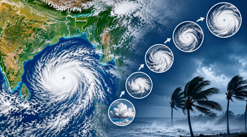
Bay of Bengal Weather System: IMD Classification From Low Pressure to Cyclone Explained
During the post-monsoon months, terms such as low-pressure area, depression, deep depression and cyclonic storm frequently appear in weather forecasts for the Bay of Bengal.
However, these terms do not all mean the same thing.
A low-pressure area over the Bay of Bengal is not automatically a cyclone. The India Meteorological Department (IMD) classifies weather systems according to their organisation and, over the sea, primarily their maximum sustained wind speed. RSMC New Delhi
Understanding these classifications can help you read weather reports correctly and avoid unnecessary panic when a new Bay of Bengal system develops.
Is There a Cyclone in the Bay of Bengal Right Now?
As of the latest IMD sea-area bulletin covering October 6, 2026, there is no storm warning for the Bay of Bengal. India Meteorological Department
IMD reported weak-to-moderate southwest monsoon conditions over the northwest Bay of Bengal and weak conditions over the remaining Bay and Andaman Sea.
The coastal bulletin also showed no port signal or storm-surge warning for the West Bengal coast for the period covered. India Meteorological Department
Therefore, reports discussing a possible weather system should not automatically be described as a cyclone unless IMD officially classifies it at cyclonic-storm strength.
What Is a Bay of Bengal Weather System?
A weather system over the Bay of Bengal usually refers to an area where atmospheric pressure is lower than its surroundings.
Under suitable conditions, thunderstorms can become increasingly organised around the low-pressure centre.
A system may progress through several stages:
Low Pressure Area → Depression → Deep Depression → Cyclonic Storm → Severe Cyclonic Storm → Very Severe Cyclonic Storm → Extremely Severe Cyclonic Storm → Super Cyclonic Storm
However, this does not mean every low-pressure area will move through all these stages.
Many systems weaken without becoming cyclones.
IMD Classification of Bay of Bengal Systems
IMD classifies cyclonic disturbances over the North Indian Ocean, including the Bay of Bengal and Arabian Sea, according to maximum sustained wind speed.
| IMD Classification | Maximum Sustained Wind |
|---|---|
| Low Pressure Area | Below 31 km/h |
| Depression | 31–49 km/h |
| Deep Depression | 50–61 km/h |
| Cyclonic Storm | 62–88 km/h |
| Severe Cyclonic Storm | 89–117 km/h |
| Very Severe Cyclonic Storm | 118–166 km/h |
| Extremely Severe Cyclonic Storm | 167–221 km/h |
| Super Cyclonic Storm | 222 km/h or higher |
This is the current detailed classification described in IMD’s tropical-cyclone FAQ. RSMC New Delhi
The key number to remember is 62 km/h.
A system reaches IMD’s Cyclonic Storm category when its maximum sustained surface winds reach at least 34 knots, or approximately 62 km/h. RSMC New Delhi
What Is a Low-Pressure Area?
A low-pressure area, often shortened to LPA or simply “low,” is the weakest stage in this classification.
Air pressure is lower than in the surrounding region, which can encourage air to converge and rise.
This may produce:
- Cloud formation
- Thunderstorms
- Increased rainfall
- Gusty winds
- Rougher sea conditions in some situations
IMD’s wind-based classification places a low-pressure area below 17 knots or 31 km/h. RSMC New Delhi
A low-pressure area should therefore not be called a cyclone.
What Is a Well-Marked Low-Pressure Area?
You may also see IMD use the term well-marked low-pressure area.
This means the low-pressure system has become better organised and more clearly defined.
It is stronger or more organised than an ordinary low-pressure area but has not yet reached depression status.
IMD includes both low-pressure areas and well-marked low-pressure areas within its terminology for cyclonic disturbances. RSMC New Delhi
A well-marked low can potentially strengthen further if atmospheric and ocean conditions remain favourable.
What Is a Depression?
A system becomes a Depression when its maximum sustained wind speed reaches approximately:
31–49 km/h
or
17–27 knots. RSMC New Delhi
This is a more organised weather system.
At this stage, IMD monitoring and warnings become particularly important because the system can produce significant rainfall and stronger winds even though it has not become a named cyclone.
What Is a Deep Depression?
The next stage is a Deep Depression.
Its maximum sustained winds are:
50–61 km/h
or
28–33 knots. RSMC New Delhi
A deep depression is just below cyclonic-storm strength.
This distinction is important because headlines sometimes describe a deep depression as a “cyclone.”
Technically, under IMD classification, it has not yet reached Cyclonic Storm status.
When Does a Bay of Bengal System Become a Cyclone?
The system officially becomes a Cyclonic Storm when maximum sustained winds reach:
62–88 km/h
or
34–47 knots. RSMC New Delhi
At this point, the system is considered a tropical cyclone under the regional classification.
This is also the stage at which a storm receives a name under the naming system used for tropical cyclones in the North Indian Ocean.
Therefore:
Depression = not yet a named cyclone
Deep Depression = not yet a named cyclone
Cyclonic Storm = cyclone and eligible for naming
What Is a Severe Cyclonic Storm?
When maximum sustained winds increase to:
89–117 km/h
IMD classifies the system as a Severe Cyclonic Storm. RSMC New Delhi
At this strength, damaging winds, heavy rainfall, rough seas and coastal impacts can become increasingly serious depending on the storm’s size, track and landfall location.
What Is a Very Severe Cyclonic Storm?
A Very Severe Cyclonic Storm, or VSCS, has sustained winds of:
118–166 km/h. RSMC New Delhi
These storms can cause major damage if they cross a populated coastline.
However, wind speed is not the only factor determining impact.
Rainfall, storm surge, terrain, population exposure and how quickly the system moves can all influence the severity of a cyclone disaster.
What Is an Extremely Severe Cyclonic Storm?
An Extremely Severe Cyclonic Storm, or ESCS, has sustained winds of:
167–221 km/h. RSMC New Delhi
This represents one of IMD’s highest cyclone classifications.
Such storms can produce destructive winds and potentially dangerous coastal conditions.
What Is a Super Cyclonic Storm?
The highest category used by IMD is:
Super Cyclonic Storm
A system enters this category when maximum sustained winds reach:
222 km/h or higher
or
120 knots or higher. RSMC New Delhi
Super cyclonic storms are relatively rare but can cause catastrophic impacts when they approach populated coastlines.
Why Does the Bay of Bengal Produce Cyclones?
Tropical cyclones require several environmental ingredients.
Warm ocean water supplies heat and moisture.
Meanwhile, rising humid air can produce thunderstorms and release heat as water vapour condenses.
IMD describes a tropical cyclone as functioning somewhat like a heat engine, with warm ocean water and humid air supplying energy. RSMC New Delhi
Other atmospheric conditions also matter, including wind patterns and the organisation of thunderstorms.
Warm sea temperatures alone do not guarantee that a cyclone will develop.
Does Every Low Pressure Become a Cyclone?
No.
This is one of the most important things to understand about Bay of Bengal weather forecasts.
A low-pressure area may:
strengthen,
remain at roughly the same intensity,
move inland,
or weaken.
Even a depression does not necessarily become a cyclonic storm.
IMD notes that only a portion of cyclonic disturbances intensify into cyclones. Historical intensification probability also varies considerably by month. RSMC New Delhi
Therefore, headlines such as “low pressure forms in Bay of Bengal” should not automatically be interpreted as “cyclone coming.”
Why Are October and November Important for Bay of Bengal Cyclones?
The North Indian Ocean has two important periods for tropical cyclone development: the pre-monsoon and post-monsoon seasons.
The post-monsoon period is particularly closely watched because the Bay of Bengal has historically produced significant cyclonic systems during October and November.
IMD’s historical data show that the probability of disturbances intensifying into cyclones varies by month, with November among the more favourable months for intensification. RSMC New Delhi
That is why weather systems forming in the Bay during October and November receive considerable attention.
What Determines Whether a System Will Strengthen?
Forecasters examine several atmospheric and oceanic conditions.
These can include:
Sea-surface temperature: Warm water can provide energy.
Ocean heat content: Warm water extending deeper below the surface can support a developing system.
Wind shear: Strong differences in wind speed or direction with height can disrupt cyclone organisation.
Atmospheric moisture: Dry air can interfere with thunderstorm development.
Upper-level winds: Favourable circulation higher in the atmosphere can help a storm develop.
Land interaction: Moving over land usually cuts a tropical system off from its main oceanic energy source.
This is why forecasts can change as atmospheric conditions evolve.
What Is Cyclone Landfall?
Landfall occurs when the centre of a tropical cyclone crosses the coastline.
However, dangerous weather can begin well before the cyclone’s centre reaches land.
Outer rain bands can bring:
- Heavy rainfall
- Strong winds
- Thunderstorms
- Rough seas
- Coastal flooding
Therefore, people should not wait for the exact landfall time before following official warnings.
What Is Storm Surge?
Storm surge is an abnormal rise in sea level generated by a storm.
Strong cyclone winds can push seawater toward the coast.
Combined with tides and local coastal geography, this can lead to dangerous inundation in low-lying areas.
Storm surge risk therefore depends on more than cyclone wind category alone.
IMD cyclone bulletins include forecasts of adverse weather such as heavy rain, gale winds and storm surge where applicable. RSMC New Delhi
How Does IMD Track a Cyclone?
IMD uses multiple sources of meteorological information to monitor tropical systems.
These include observations from:
- Weather satellites
- Doppler Weather Radars
- Ships and buoys
- Surface weather stations
- Upper-air observations
- Numerical weather prediction models
Once a system reaches depression stage, IMD’s Cyclone Warning Division issues regular bulletins covering the system’s location, intensity, movement and forecast.
When a system becomes a cyclonic storm, bulletins can be issued at three-hour intervals. RSMC New Delhi
What Do IMD Cyclone Warnings Mean?
IMD’s cyclone warning system for the Indian coast includes several stages:
Pre-Cyclone Watch
Cyclone Alert
Cyclone Warning
Post-Landfall Outlook
followed by de-warning when appropriate. RSMC New Delhi
These alerts should be distinguished from the storm’s intensity classification.
For example, Cyclone Warning describes a warning stage, while Severe Cyclonic Storm describes the intensity of the weather system.
They are not the same thing.
Why Can a Depression Still Be Dangerous?
The word “depression” can sound relatively harmless compared with “cyclone.”
However, a depression can still produce dangerous weather.
Heavy rainfall associated with a depression can cause:
- Urban flooding
- River flooding
- Landslides
- Waterlogging
- Damage to crops
- Difficult travel conditions
Therefore, people should follow rainfall and local impact warnings even if a system never reaches cyclonic-storm strength.
How Should You Read Bay of Bengal Cyclone News?
When you see a headline about a new system, check four things.
1. Current classification
Is it a low-pressure area, depression, deep depression or cyclonic storm?
2. IMD forecast
Has IMD actually forecast intensification?
3. Expected track
Which coast or region could potentially be affected?
4. Local warnings
Are there official rainfall, wind, sea or evacuation warnings for your area?
Avoid relying only on viral maps or social-media posts showing long-range cyclone tracks.
Forecast tracks and intensities can change.
Is There a Bay of Bengal Cyclone Warning Today?
As of IMD’s sea bulletin valid into October 6, 2026, the answer is no.
The bulletin explicitly states:
“No Storm Warning.” India Meteorological Department
IMD does have thunderstorm and lightning warnings for parts of West Bengal during the coming days, but these should not be confused with a Bay of Bengal cyclone warning. India Meteorological Department
For the latest official information, use the India Meteorological Department or the IMD Regional Specialized Meteorological Centre for Tropical Cyclones.
Frequently Asked Questions
What is a Bay of Bengal system?
It usually refers to an area of disturbed weather or low atmospheric pressure developing over the Bay of Bengal. Its classification depends on its organisation and intensity.
Is a low-pressure area a cyclone?
No. Under IMD classification, a low-pressure area is below depression and cyclonic-storm strength. RSMC New Delhi
When does a depression become a deep depression?
A system is classified as a Deep Depression when maximum sustained winds reach 50–61 km/h. RSMC New Delhi
At what wind speed does IMD call a system a cyclone?
A system becomes a Cyclonic Storm when maximum sustained winds reach at least 62 km/h or 34 knots. RSMC New Delhi
When does a cyclone get a name?
In the North Indian Ocean, naming occurs once the system reaches Cyclonic Storm intensity.
What is the strongest IMD cyclone category?
Super Cyclonic Storm, with maximum sustained winds of 222 km/h or higher. RSMC New Delhi
Does every Bay of Bengal depression become a cyclone?
No. Some intensify while others remain depressions or weaken. Historical IMD data show that only a portion of cyclonic disturbances develop into cyclones. RSMC New Delhi
Is there a cyclone in the Bay of Bengal today?
As of the IMD bulletin valid into October 6, 2026, there is no storm warning for the Bay of Bengal. India Meteorological Department
Conclusion
Understanding the Bay of Bengal system and IMD classification makes weather forecasts much easier to interpret.
A low-pressure area is not automatically a cyclone. A developing system must strengthen through the depression and deep-depression stages before reaching Cyclonic Storm intensity at sustained winds of at least 62 km/h. RSMC New Delhi
From there, IMD classifications progress through Severe, Very Severe and Extremely Severe Cyclonic Storm before reaching the highest category, Super Cyclonic Storm.
As of October 6, 2026, IMD has no storm warning for the Bay of Bengal. India Meteorological Department
For any future developing system, follow IMD’s latest classification rather than assuming that every low-pressure forecast means a cyclone is approaching.